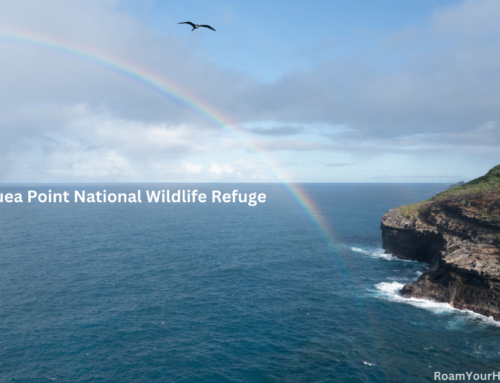

Pipiwai Trail Guide: Haleakalā National Park
We woke up an hour and a half before sunrise, determined to get a very early start on the Pīpīwai Trail. The hike is in the Kīpahulu District of Haleakala National Park on the island of Maui in Hawaii.
The Kīpahulu District of Haleakala on the southern coast of Maui gets far fewer visitors than the park’s main area. That’s because you have to drive the famously windy and narrow Road to Hana to get there. That drive, with its 620 curves and 59 one-lane bridges, is an adventure in and of itself. Most people who visit make it a day trip because there are few places to stay, and camping is limited.
- Trail Name: Pipiwai Trail
- Trailhead Location: Kipahulu Visitor Center
- Distance: 4 Miles Roundtrip
- Difficulty: Strenuous
- Elevation Gain: ~950 feet
- Type: Out & Back
- Features:
- Dogs: No
We were lucky. My wife and I got a site at Kīpahulu Campground. It was right on the ocean and one of the most stunning places we have ever pitched a tent. It was still dark when we rumbled awake. Some songbirds were starting to sing, and the relaxing sound of the waves crashing on the nearby rocks made breaking down camp a reluctant experience. “Are you sure you don’t want to relax a little longer? This is so nice.” My wife said with a sort of groan. “Nah, we have got to get moving! We had a big hike planned for the morning.” I said back to her. “Waterfalls and switchbacks headed our way!”
The sun was starting to rise, so we decided to hit the trail. From the parking lot of the Visitor Center, a trail pointed left for the Pīpīwai Trail and right for the Kūloa Point, a short and beautiful hike we had done the evening before.
To the left, we went. The trail entered a thick, vibrant green forest and immediately started climbing. The air was dense, moist, and cool. “WARNING” Flash floods, slippery rocks, and swift currents have resulted in injury and death. USE CAUTION BE ALERT. Your safety depends upon your own good judgment,” a sign warned at the start of another rocky uphill section.

Makahiku Falls Overlook
After about half a mile, we came to the Makahiku Falls Overlook, adorned with another sign warning that people had died when they got off the trail. The view was very nice, but some vegetation blocked part of the view of the 184-foot waterfall.
He wai makamaka ‘ole was written on a sign that explained it meant “water that recognizes no friend.” The Hawaiin proverb was a friendly reminder to respect the power of nature. Which seemed fitting here. The waterfall entered a narrow canyon with steep walls that were clearly prone to flash flooding.

Giant Banyan Tree
After enjoying the view, we hiked to the “Giant Banyan Tree.” It was impressive! It was huge, with dozens of branches going in every direction. While the picture does not entirely do it justice, it gives you an idea of how cool it is.
We hiked past the banyan tree towards a wooden bridge over a stream. “Hey, look to the left,” my wife said. “Oh, that’s cool!” I replied. Two smaller waterfalls spilled into pools just off the bridge.

Bamboo Forest
At this point, the sun was definitely up, and it was getting warm. You could really feel it on the bridge. Then, directly after the bridge, the temperature dropped 15 degrees, and the sun simply went away.
We were entering the “Bamboo Forest” section of the trail. This part of the hiking was super cool. The bamboo, for the most part, blocked out direct sunshine. The trail was rocky in places, very muddy in places, and an enjoyable boardwalk in others.

Waimoku Falls
Once we got out, we soon caught our first glimpse of Waimoku Falls. We caught a few views but marched on to the end. The sun was just starting to illuminate the top of the falls when we arrived. Another sign warning, “DO NOT PASS THIS POINT FATALITIES HAVE OCCURED,” was posted right at the end of the trail.
The view was incredible! The falls drop nearly vertically for 400 feet, making it one of the tallest in Maui. There was another sign explaining that Waimoku can mean several things in native Hawaiian, including water that cuts, severs, amputates, or breaks in two, as a stream often does during heavy rains. This brought back to mind the proverb from earlier to me.
We stayed for about 20 minutes at the falls, taking it in and enjoying the views. A few other hikers who were behind us joined and left while we were there.
The sun was getting higher into the sky, and we still had to drive the Road to Hana back out today, so we decided to leave.
Hiking back to the trailhead
We worked our way back out the same way we came. We went through the bamboo forest, across some boardwalks, and past the banyan tree until we got to Makahiku Falls Overlook again. We stopped there for a break.
“Oh my god,” I said aloud after taking a big drink of water. There is a naked man at the top of the falls!” “What! Where?” my wife said back to me. “Wow, that is so dangerous.” I’m unsure if he noticed us noticing him, but he carefully and quickly made his way off the top of the waterfall and out of site. We joked a bit more and explained to some hikers coming up the trail about what they were relieved to have missed!
After the display of public nudity and waterfalls, we quickly hiked the last half mile, satisfied with a beautiful morning hike.
If you are in the area, make time for the Pīpīwai Trail. I can’t recommend enough getting a campsite the night prior so you can beat the crowds and get an early start before it gets hot!